
Hurricane Ian became Tropical Storm Ian overnight, as he worked his way slowly up the heart of Florida, on his way toward the Atlantic Ocean, with eyes on South Carolina and North Carolina.
Coastal areas in North Carolina and South Carolina are now under Tropical Storm Warning at minimum, and North Carolina Gov. Roy Cooper has issued a State of Emergency for the state.
“A State of Emergency is needed now so that farmers and those preparing for the storm can more quickly get ready for the heavy rain that is likely to fall in much of our state,” said Governor Cooper. “North Carolinians should stay aware, keep a close eye on the forecast and prepare their emergency supplies.”
The order waives the size and weight requirements for vehicles engaged in relief efforts before, during and after the severe weather, including power restoration and debris removal, as well as the transportation of goods like food, fuel, and medical supplies. The order also helps North Carolina’s agricultural sector by temporarily suspending weighing of vehicles used to transport livestock, poultry or crops ready to be harvested. The Council of State concurred with the waiver of transportation regulations in the order today.
In addition, North Carolina’s price gouging law against overcharging in a state of emergency is now in effect statewide.
Here’s a look at what’s going on with Tropical Storm Ian as of 8:30 Thursday morning, and his upcoming impact on North Carolina. Check back all day, as we’ll keep you posted.
Rain Forecast
As you can see from the National Weather Service projection, rain will impact much of South Carolina and North Carolina, between tonight and Sunday.
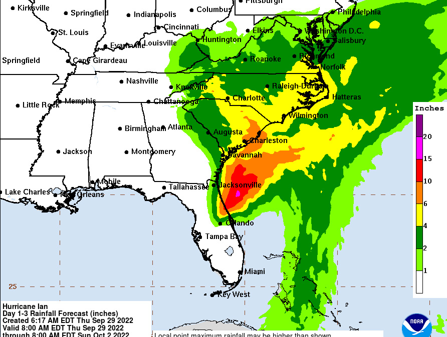
Image Courtesy National Weather Service.
Wind Field Projections
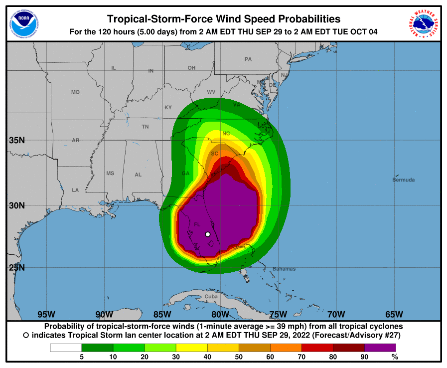
Image Courtesy National Weather Service.
